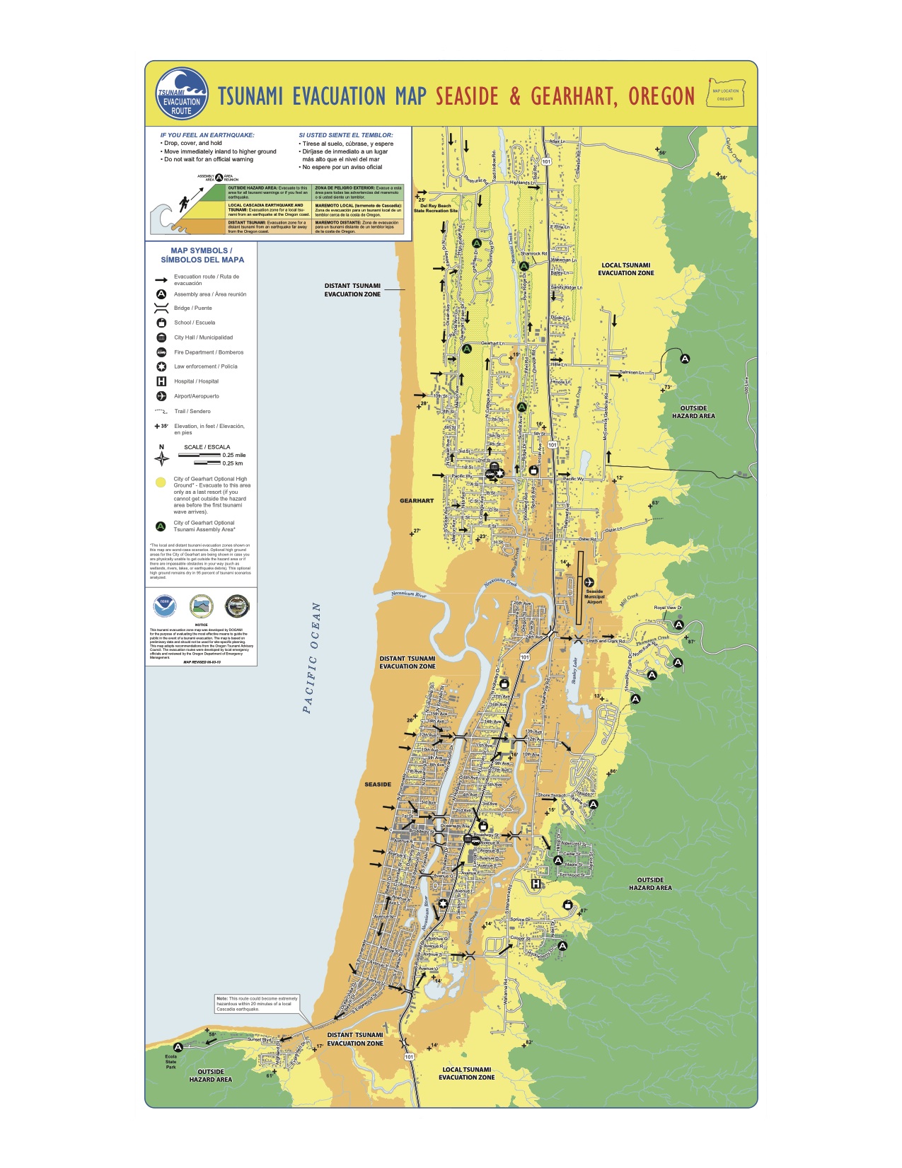
DOGAMI has just released an amazing series of tsunami maps for the entire Oregon coast. They include the latest tsunami evacuation maps that show the inundation area of the largest tsunami generated from a distant event (in this case a tsunami generated by a subduction zone earthquake generated in Alaska), and a worst case Cascadia earthquake and tsunami. This latest generation tsunami inundation mapping started with the Cannon Beach map, shifted down to southern Oregon and is now completed for the coast and mouth of the Columbia River. These maps build on the previous generation maps and, by incorporating the best current science and modeling, can help prevent the significant loss of life such as experienced in Tohoku. The proviso is that Oregon and the coastal communities must maintain effective tsunami evacuation planning and education.
The other set of maps in many ways are even more remarkable. The Tsunami Inundation Map (TIM) series show the range of tsunami inundations of different size events from the Cascadia and Alaskan subduction zone earthquakes. For the Cascadia events, there grouped in various sizes and likelihoods and provide data for planning efforts of local communities. While evacuation efforts must plan for worst case scenarios, other planning efforts can set the bar at other risk levels. This transparency of risk allows communities and individuals to select levels for which they are comfortable and for others to understand them as well. As Oregon coastal communities look to become resilient in the face of a Cascadia earthquake/tsunami, these maps will help them manage the process.
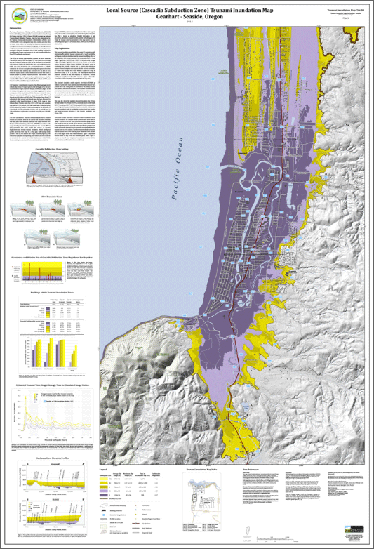
Backing up these maps is an impressive amount of data that can be used by design professionals to design tsunami resistant buildings. They provide accurate water depths and velocities for each of the mapped scenarios. The Cannon Beach data was used in the conceptual design of the Cannon Beach City Hall/Tsunami evacuation building that I was involved in. The engineering was based on FEMA’s Guidelines for Design of Structures for Vertical Evacuation from Tsunamis. These guidelines are slowly making their way through the code process and will eventually become part of the building codes. Hopefully, the mapping data will become easily available for tsunami refuge projects for the coast.
When you combine this information with vulnerability data from tsunami’s generated by Nate Wood of USGS, the information gathered by the Oregon Resilience Plan, the base information is now available to transform the coastal communities. They can now address where they want to go and how to get there. Not an easy process, but steps are already being taken.
Kudos to the efforts of DOGAMI and all the participants in the mapping efforts (with special call outs to George Priest, Rob Witter, Chris Goldfinger, Z. Yhang, K.Wang, L.L. Stimely, J.T. English, and P.A. Ferro who developed the method to model the tsunami hazards that generated the maps).